
Let’s Capture The Big Picture
Services
High Precision Orthomosaic

Our drone-based orthomosaic mapping services provide crystal-clear, georeferenced imagery to support surveying, planning, monitoring, and documentation needs across a range of industries.
Whether you’re managing a construction site, surveying land, or monitoring agricultural fields, our orthomosaics deliver the accuracy and visual clarity you need — fast.
Orthomosaics are provided in JPG format, but can also be provided with KMZ and/or GeoTIFF formats.
Volumetric Analyses
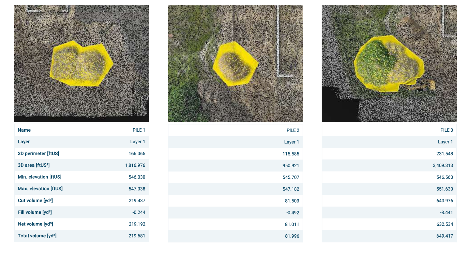
Managing stockpile volumes, tracking earthwork progress, or validating subcontractor quantities? Our drone-based volumetric analysis services deliver precise data faster and safer than traditional ground methods — saving you time, money, and rework.
Analyses are provided in PDF format, but can also be provided with CAD and/or GIS deliverables.
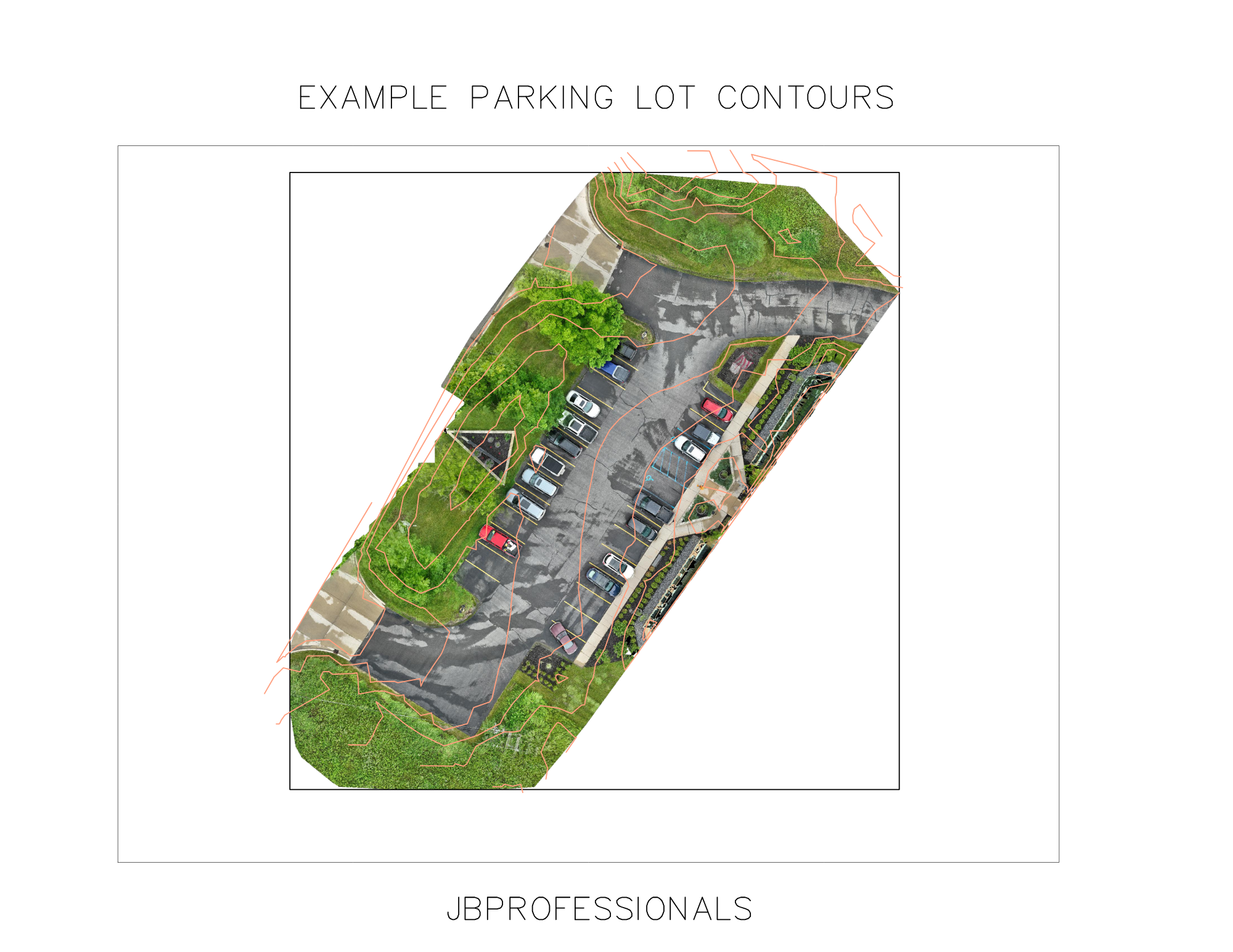
Survey / Topographic Mapping
We provide high-precision drone surveying and topographic mapping services for engineers, developers, contractors, and landowners who need fast, reliable site data. From rough terrain to large tracts of land, our aerial systems capture surface details with centimeter-grade accuracy.
Maps are provided in PDF format, but can also be provided with DWG and/or DXF deliverables.
Contact Us
Have a project in mind? Let’s talk.
Whether you're looking for a one-time drone survey or ongoing mapping services, we’re here to help. Fill out the form below or give us a call